Please use this identifier to cite or link to this item:
http://hdl.handle.net/10267/1203| Title: | GIS 222-01, Geographic Information Systems, Spring 2007 |
| Authors: | Ekstrom, Carol L. |
| Keywords: | Interdisciplinary programs;GIS;Syllabus;Text;Curriculum;2007 Spring |
| Issue Date: | 25-Feb-2008 |
| Publisher: | Memphis, Tenn. : Rhodes College |
| Abstract: | The main objective of this one-hour course is to show you the multiple uses of Geographic Information Systems (GIS) and Virtual Globes to answer questions from a variety of disciplines. The team-teaching of this course by faculty from five different departments demonstrates this technology’s diverse utility. Another objective of this course is to give you hands-on experience with ArcGIS, the most widely used GIS application. You will be expected to complete projects (see above) and to generate a GIS project in which you answer a question of your making and present this to the class. Through this activity you will gain a deeper understanding of spatial analysis in answering questions about the world in which you live. |
| Description: | This syllabus was submitted to the Rhodes College Office of Academic Affairs by the course instructor. |
| URI: | http://hdl.handle.net/10267/1203 |
| Appears in Collections: | Course Syllabi |
Files in This Item:
| File | Description | Size | Format | |
|---|---|---|---|---|
| 2007-sp_GIS_222-01.pdf | 81.02 kB | Adobe PDF | 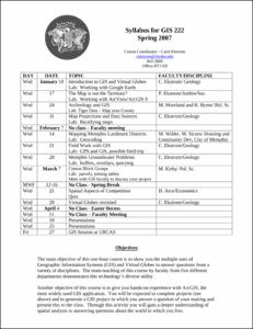 View/Open |
Items in DSpace are protected by copyright, with all rights reserved, unless otherwise indicated.