Please use this identifier to cite or link to this item:
http://hdl.handle.net/10267/31164
Full metadata record
| DC Field | Value | Language |
|---|---|---|
| dc.contributor | Memphis Public Library: Memphis Room | - |
| dc.coverage.temporal | Shelby County | - |
| dc.coverage.temporal | Crittenden County | - |
| dc.date.accessioned | 2017-12-15T16:50:40Z | - |
| dc.date.available | 2017-12-15T16:50:40Z | - |
| dc.identifier.uri | http://hdl.handle.net/10267/31164 | - |
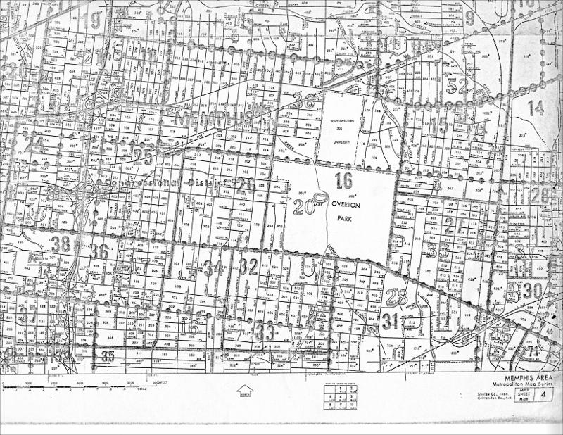
| dc.description | Map M-25 covering Memphis' metropolitan area. | - |
| dc.publisher | Metropoloitan Map Series | - |
| dc.subject | Maps | - |
| dc.subject | Memphis (Tenn.) | - |
| dc.title | Memphis Area Metropolitan Map, Section M-25 | en_US |
| dc.type | Still image | en_US |
| dc.identifier.rhodes | Memphis Area Metropolitan Map M-25 | - |
| Appears in Collections: | Historic Memphis Maps | |
Files in This Item:
| File | Description | Size | Format | |
|---|---|---|---|---|
| Memphis Area Metropolitan Map M-25 | 2.47 MB | JPEG |  View/Open |
Items in DSpace are protected by copyright, with all rights reserved, unless otherwise indicated.